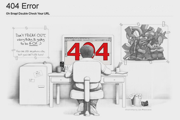
测绘工程专业英语(20-30).doc

上传人:sk****8 文档编号:2261356 上传时间:2019-05-03 格式:DOC 页数:30 大小:253KB
下载 相关 举报
测绘工程专业英语(20-30).doc_第1页
第1页 / 共30页
测绘工程专业英语(20-30).doc_第2页
第2页 / 共30页
测绘工程专业英语(20-30).doc_第3页
第3页 / 共30页
测绘工程专业英语(20-30).doc_第4页
第4页 / 共30页
测绘工程专业英语(20-30).doc_第5页
第5页 / 共30页
点击查看更多>>
资源描述

1、测绘工程专业英语全文翻译(Unit2030)Unit 20 Understan ding the GPS(认识 GPS)What Is GPS?(什么是 GPS)The global Positioning System (GPS) operated by the U .S. Department OF Defense (DOD)is a satellite-based system that can be used to locate positions anywhere on the earth(.全球定位系统(GPS) ,由美国国防部管理,是一个基于人造卫星的系统,可以用来在全球任何地方

2、定位)GPS provides continuous (24 hours/day), real-time, 3-dimensional positioning, navigation and timing worldwide.(GPS 提供全世界范围内的全天候,实时,三维坐标,导航和授时的功能。 )Any person with a GPS receiver can access the system, and it can be used for anyapplication that requires location coordinates.(任何拥有一台 GPS 接收机的人都可以使用这

3、套系统,可以应用于任何需要位置坐标的工作中)The GPS system consists of three segments: the space segment: the GPS satellitesthemselves, the control segment, operated by the U .S. military, and the user segment,which includes both military and civilian users and their GPS equipments(.GPS 由三个部分组成:太空部分:GPS 卫星自己,地面控制部分,由美国军方

4、控制,用户部分,包括军方和民用用户和他们的装备。 )Space Segment: The GPS Constellation(太空部分: GPS 星座)The first GPS satellite was launched by the U .S. Air Force in early 1978.(第一颗 GPS 卫星由美国空军在 1978 年的早些时候发射的)There are now 24 satellites orbiting the earth at an altitude of about 10,900 miles.(现在有24 颗卫星在绕地球大约 10900 英里的高度运行)Th

5、e high altitude insures that the satellite orbits are stable, precise and predictable, and that the satellites motion through space is not affected by atmospheric drag.(这么高的高度确保了卫星轨道是稳定、精确和可知的,并且确保了卫星穿过太空的运行不受到大气阻力的影响)There are four satellites in each of 6 orbital planes.(6 个轨道平面中每个有 4 颗卫星。 )Each pl

6、ane is inclined 55 degrees relative to the equator, which means that satellites crosstie equator tilted at a 55 degrees angle.(每个平面相对于赤道面倾斜 55 度,这就意味着这些卫星以 55 度角穿过赤道)The system is designed to maintain full operational capability even if two of the 24satellites fail.(这套系统被设计成即使 24 颗卫星的 2 颗故障也能维持全工作能力

7、)These 24 satellites make up a full GPS constellation.(这 24 颗卫星组成了一个完整 的 GPS 星座)The GPS satellites are powered primarily by sun-seeking solar panels, with nicad batteries providing secondary power.(GPS 卫星主要由太阳定向太阳能电池板提供动力,镍镉蓄电池提供备用动力)Each GPS satellite has four atomic clocks on board, only one of wh

8、ich is in use at a time. These highly accurate atomic clocks enable GPS to provide the most accurate timing system that exists. (每一个 GPS 卫星有四个原子钟,某一时刻只有一台在使用。这些高精度原子钟能够使 GPS 提供最准确的时间系统)Control Segment: U.S. DOD Monitoring(控制部分:美国国防部监控)The U .S. Department Of Defense maintains a master control statio

9、n at Falcon Air Force Base in Colorado Springs.(美国国防部维持了一个主控站,在科罗拉多斯普林斯的佛肯空军基地)There are four other monitor stations located in Hawaii, Ascension Island, Diego Garcia and Kwajalein.(还有 4 个监控站座落在夏威夷、阿松森岛、迭哥加西亚岛、卡瓦加兰岛)The DOD stations measure the satellite orbits precisely.(DOD 站精确测量卫星轨道)Any discrepan

10、cies between predicted orbits and actual orbits are transmitted back to the satellites.(任何预报轨道和实际轨道之间的偏差被传回卫星。 )The satellites can then broadcast these corrections, along with the other position and timing data, so that a GPS receiver on the earth can precisely establish the location of each satelli

11、te it is tracking.(然后卫星可以广播这些改正值 连同位置和时间数据一起,以便地球上的 GPS 接收机可以精确确定它所跟踪的每个卫星的位置)User Segment: Military and Civilian GPS Users (用户部分:军方和民用 GPS 用户)The U .S. military uses GPS for navigation, reconnaissance, and missile guidance systems.(美国军方把 GPS 用在导航、侦察和导弹制导系统上 Civilian use of GPS developed at the same

12、 time as military uses were being established, and has expanded far beyond original expectations.(GPS 的民用在军用建立起之时就发展起来了,并且已经发展的远远超过起初的期望)There are civilian applications for GPS in almost every field, from surveying to transportation to natural resource management to agriculture.(GPS 的民用用途几乎 用在每个领域,从

13、测量到交通到自然资源管理到农业)Most civilian uses of GPS, however, fall into one of three categories: navigation, positioning and timing.(然而, GPS 的大部分民用用途,分为三种类型:导航、定位和授时。 )How Does GPS Work?( GPS 如何工作)A GPS receiver calculates its position by a technique called satellite ranging, which involves measuring the dist

14、ance between the GPS receiver and the GPS satellites it is tracking.(GPS 接收机利用一项被称为卫星测距的技术,计算它自己的位置,涉及到 GPS 接收机到它所跟踪的 GPS 卫星的距离测量)The range (the range a receiver calculates is actually a pseudorange, or an estimate orange rather than a true range) or distance is measured as elapsed transit time.(距离(

15、接收机测的距离实际上是伪距,或者说是距离估值,而不是真实距离)是用传播时间来测的)The position of each satellite is known, and the satellites transmit their positions as part of the “ messages” they send via radio waves.(每个卫星的位置已知,并且卫星将它们的位置作为它们用无线电波发出的“讯文” 的一部分传送出去)The GPS receiver on the ground is the unknown point, and must compute its

16、position based on the information it receives from the satellites.(地面 GPS 接收机是未知点,必需基于它从卫星收到的这些信息计算它的位置。 )The first step in measuring the distance between the GPS receiver and a satellite requires measuring the time it takes for the signal to travel from the satellite to the receiver.(测量 GPS 接收机和卫星的

17、第一步,要求测出从卫星到接收机的信号传播时间。 )Once the receiver knows how much time has elapsed, the travel time of the signal multiplies the speed of light (because the satellite signals travel at the speed of light, approximately 186,000 miles per second) to compute the distance.(一旦接收机知道用了多少时间,用信号的传播时间乘上光速(因为卫星信号以光速传播

18、,大约 186,000 英里每秒)来计算距离。 )Distance measurements to four satellites are required to compute a 3-dimensional (latitude, longitude and altitude) position.(计算一个三维(纬度、精度和高程)位置需要 4 颗卫星的距离值)In order to measure the travel time of the satellite signal, the receiver has to know when the signal left the satelli

19、te and when the signal reached the receiver.(为了测出卫星信号的传播时间,接收机需要知道信号是什么时候离开卫星的和什么时候到达接收机的)Knowing when the signal reaches the receiver is easy, the GPS receiver just “ checks” its internal clock when the signal arrives to see what time it is(.确定信号到达接收机的时间容易,GPS 接收机只需在信号到达时 “检查”自己内置的钟,看看是什么时间)But how

20、 does it “know” when the signal left the satellite?(但是怎样“ 知道”信号何时离开卫星的呢?)All GPS receivers are synchronized with the satellites so they generate the same digital code at the same time.(所有 GPS 接收机与卫星是同步的,因此它们在同一时间产生同样的信号码)When the GPS receiver receives a code from a satellite, it can look back in its

21、 memory bank and “remember” when it emitted the same code(.当 GPS 接收机收到一个从卫星来的码时,它可以在它的内存条中回忆并“记起 ”它发出的相同码) This little “ trick” allows the GPS receiver to determine when the signal left the satellite.(这个小小的 “技巧”使得 GPS 接收机能够确定信号是 何时离开卫星的)Once the receiver has the distance measurements, its basically

22、a problem of geometry(.一旦接收机测出了距离,基本上就只有几何上的问题了)If it “ knows” where the four satellites are, and how far it is from each satellite, it can compute its location through trilateration. Heres an illustration of how it works.(如果知道了 4 颗卫星的位置,距每颗卫星的距离,就可以通过三边测量来计算它的位置。这里有个例子说明它如何工作的)The GPS receiver “ lo

23、cks on” to one satellite and calculates the range to be 12,000 miles.(GPS 接收机“ 锁定 ”一颗卫星并计算出距离为 12,000 英里)This fact helps narrow the receiver location down, but it only tells us that we are somewhere on a sphere which is centered on the satellite and has a 12,000 mile radius.(这把接收机的位置限定下来,但是它只能告诉我们在一

24、个以这个卫星为中心,半径 12,000 英里的球面上)Many of the locations on that sphere are not on earth, but out in space.(这个球面的许多位置不在地球上,而在太空中)Now,consider that the receiver picks up a signal from a second satellite and calculates the range between the receiver and the satellite to be 10,000 miles.(现在,考虑这个接收机从第二颗卫星获得一个信号

25、,计算出接收机到这颗卫星的距离是 10,000 英里)That means we are also somewhere on a sphere with a 10,000 mile radius with the second satellite at the center.(这就意味着我们也在一个以第二颗卫星为中心、半径 10,000 英里的球面上的某处)We must, therefore, be somewhere where these two spheres intersect.(因此,我们肯定在这两个球面相交的某处。 )When the two spheres intersect,

26、 a circle is formed, so we must be somewhere on that circle.(当这两个球面相交时,一个圆圈形成了,因此我们肯定在这个圆圈的某处)If the receiver picks up another satellite, says at 11,000 miles away, another sphere is formed, and there are only two points where the three spheres intersect.(如果接收机“ 拾取”了另一个卫星,比方说11,000 英里以外,另一个球面形成了,三个球

27、面相交只有两个交点)Usually the receiver can discard one of the last two points because it is nowhere near the earth.(通常接收机可以丢弃最后这两点中的一个点,因为它离地球差的 远)So, were left with one point which is the location of the GPS receiver.In practice, a fourth measurement is needed to correct for clock error(.这样我们留下一个点,它是 GPS 接

28、收机的位置。在实际当中,需要第四个观测值来修正时间误差)Uuit21 Understanding the GPS (II) 认识 GPS(II)GPS Error Sources (GPS 误差来源 )There are many sources of possible errors that will degrade the accuracy of position computed by a GPS receiver.(有许多或然误差来源, 这种误差 会降低 GPS 接收机计算的位置的准确度)The travel time of GPS satellite signals can be a

29、ltered by atmospheric effects; when a GPS signal passes through the ionosphere and troposphere it is refracted, causing the speed of the signal to be different from the speed of a GPS signal in space.(GPS 卫星信号的传播时间会因大气影响而改变;当 GPS 信号穿过电离层和对流层时会发生折射,因为信号速度与在太空中信号的速度不同。 )Sunspot activity also causes in

30、terference with GPS signals(.太阳黑子活动也对 GPS 信号产生干扰)Another source of error is measurement noise, or distortion of the signal caused by electrical interference or errors inherent in the GPS receiver itself.(另一个误差源是测量噪声,或者是由于电干扰或 GPS 接收机自己固有的误差引起的信号失真)Errors in the ephemeris data (the information about

31、satellite orbits) will also cause errors in computed positions, because the satellites weren t really where the GPS receiver “thought” they were (based on the information it received) when it computed the positions.(星历数据(关于卫星轨道的信息)误差也会引起位置的误差,因为当计算位置时,卫星不真正地在接收机“ 认为”它们在的地方(基于它接受的信息所知道) )Small variat

32、ions in the atomic clocks (clock drift) on board the satellites can translate to large position errors; a clock error of 1 nanosecond translates to 1 foot or 0 .3 meters user error on the ground.(卫星原子钟内的很小的变化(钟漂)能转化成很大的位置误差;一纳秒的钟差能造成 1 英尺或 0.3 米的地面用户误差)Multi path effects arise when signals transmitt

33、ed from the satellites bounce off a reflective surface before getting to the receiver antenna.(当从卫星发射的信号在到达接收机天线 之前,被一个反射面反射时,多路径效应出现了)When this happens, the receiver gets the signal in straight line path as well as delayed path(multiple paths). The effect is similar to a ghost or double image on a

34、TV set(.当这种情况发生时,接收机接收直线路径来的信号,也接收延迟路线(多路径)来的信号。其效果与电视的重影或重像类似)How to Reduce GPS Errors(如何减小 GPS 的误差)Youve probably heard people talk about getting 2 to 5 meters accuracy with a GPS receiver, or even centimeter or millimeter accuracy(.你可能听说过有人说 GPS 接收机可以达到 2 到 5 米的准确度,甚至是厘米或毫米级精度)Is there a way to c

35、ancel out the errors and get satisfied accuracy?(有方法低偿误差并获得满意的精度吗?) The answer is yes, but the level of accuracy depends on the type of equipment you are using.(回答是肯定的,但是准确度的级别依赖于你使用的装备的类型)The following discussion describes a technique used to achieve 2 to 5 meters accuracy using mapping (resource)

36、grade receivers.(下面的讨论描述了一种用于绘图(资源)级接收机的技术,能够获得 2 到 5 米的准确度)Some mapping grade receivers are even capable of sub-meter accuracy, but the increased accuracy comes at a price.(一些绘图级的接收机甚至能够达亚米级精度,但是精度的提高是以很高代价带来的 Survey grade receivers are the most accurate, capable of centimeter or even millimeter ac

37、curacy, depending on the equipment, but they use more advanced techniques to achieve this level of accuracy and, naturally, are more expensive.(测地级接收机最精确,凭装备能够达到厘米甚至是毫米级精度,但是它们是使用更先进的技术才得到这样的精度水平,自然地,就更昂贵。 )Recreational grade receivers usually can receive real-time differential corrections, but they

38、 cannot store a file that can be differentially corrected using post-processing methods.(休闲级的接收机通常可以接收实时差分改正,但是它们不能存储文件,以便可以用后处理方法差分改正。 )Differential Correction(差分改正)Differential correction is a method used to reduce the effects of selective available (SA) and other sources of GPS positioning error

39、(differential correction cannot correct for multipath or receiver error; it counteracts only the errors that are common to both reference and roving receivers).(差分改正是一种用来减小 选择可用性政策 (SA)影响和其它 GPS 定位误差源 的方法(差分改正不能修正多路径效应或接收机误差;它只能抵消基准接收机和流动接收机所共有的误差)It requires, in addition to your “ roving” GPS recei

40、ver, a GPS receiver on the ground in a known location to act as a static reference point.(这需要除了你的“流动”GPS 接收机之外 一个 GPS 接收机在地面上一个已知的位置担当参考点)This type of setup is often called a GPS base station. Since the base station “ knows” where it is, it can compute the errors in its position calculations (in rea

41、lity, it computes timing errors) and apply them to any number of roving receivers in the same general area.(这种设备经常被称为 GPS 基准站。由于基准站“知道”在哪儿,它就可以计算它自己的位置误差(实际上,它是计算 定时误差) ,并将它们应用于将应用于】许多同一区域的流动接收机)This requires that the base and rover receivers “ see” the same set of satellites at the sametime.(这需要基准接

42、收机和流动接收机同时“看到” 相同一批卫星)The base station, depending upon how it is configured, can correct roving GPS receiver data in one (or both) of two ways.(基准站,依照如何配置,可以用两种中的一种方法(或同时用两种)对 GPS 流动接收机的数据进行修正)in the first method, called real-time differential correction or real-time differential GPS (DGPS), the bas

43、e station transmits (usually via radio link) error correction messages to other GPS receivers in the local area.(第一种方法,称为实时差分改正或实时差分 GPS(DGPS) ,基准站发射(通常经由无线电联系)误差改正信息到其它当地的 GPS 接收机)In this case, the positions you read on your GPS receiver while you are out collecting data are the corrected positions

44、.(这样,当你外出收集数据时在你的 GPS 接收机上读出的位置就是改正后的位置。 ) the second method, called post-processed differential correction, is performed on a computer after the roving receiver data are collected.(第二种方法,称为后处理差分改正,在流动站数据收集完后经由计算机完成的)While you are out in the field collecting data, the positions you read on your rovi

45、ng GPS receiver are uncorrected.(当你在野外收集数据时,你在 GPS 流动接收机上读出的位置是未经修正的)It is not until you take the rover files back to the office and process them using differential correction software and data from the base station file, that you get corrected positions(.直到你把流动站文件带回办公室并利用差分改正软件和基准站的文件数据进行处理,你才能得到改后

46、位置)The base station file contains information about the timing errors.(基准站文件包括同步误差信息)This information allows the differential correction software to apply error corrections to the roving receiver file during processing(.这种信息可以在处理时使差分改正软件把误差改正施于流动接收机文件上。 )Since the base and rover receivers have to “s

47、ee” the same set of satellites at the same time, the base file has to start before the rover file starts, and end after the rover file ends (a base station is normally set up to track all satellites in view, insuring that it will “ see” at least the four satellites that the roving receiver is using

48、to compute positions)(.由于基准站接收机和流动站接收机必需同时 “看到”同一组卫星,基准站文件必需开始于流动站文件之前,结束于流动站文件之后(基准站通常设置为跟踪所有视野内的卫星,以保证至少“看到” 流动站接收机用来计算位置的 4 颗卫星) )Post-processed differential correction, then, requires both base and rover receivers that are capable of collecting and storing files.(后处理差分改正,要求基准站接收机和流动接收机都能收集和存储文件。

49、 )Most recreational grade receivers cannot collect and store files that can be differentially corrected.(多数休闲级接收机不能收集和存储可以用来差分改正的文件)How Accurate Is GPS?( GPS 准确度如何?)The accuracy that can be achieved using GPS depends on the type of equipment used, the time of observation, the positions of the satellites being used to compute positions, the model and the software you used.(使用 GPS 可以达到的准确度依赖于使用装置的类型、观测时间、用来计算位置的卫星的位置、你所使用的模式和软件)In general, recreational and mapping grade receivers using C/A code without differential correction are accurate to be

展开阅读全文
相关资源
相关搜索

当前位置:首页 > 教育教学资料库 > 课程笔记

Copyright © 2018-2021 Wenke99.com All rights reserved

工信部备案号浙ICP备20026746号-2  

公安局备案号:浙公网安备33038302330469号

本站为C2C交文档易平台,即用户上传的文档直接卖给下载用户,本站只是网络服务中间平台,所有原创文档下载所得归上传人所有,若您发现上传作品侵犯了您的权利,请立刻联系网站客服并提供证据,平台将在3个工作日内予以改正。